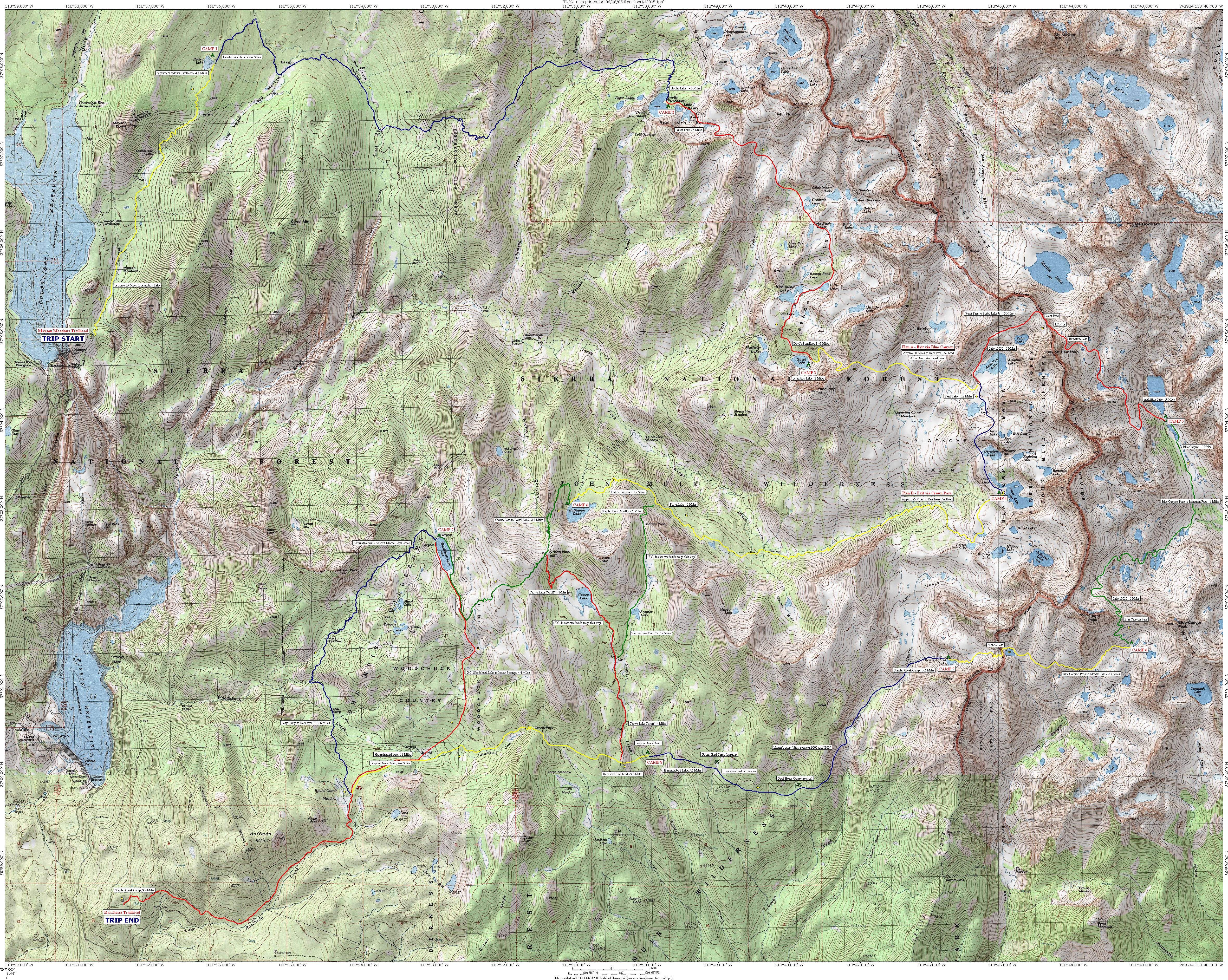
| Plan A - Shuttle Trip from Maxson Trailhead to Rancheria Trailhead, via Blue Canyon |
| Segment | Distance | Camp |
| Maxson Trailhead to Hobler Lake | 4.5 Miles | CAMP 1 |
| Hobler Lake to Devil's Punchbowl, via Fleming Creek and Post Corral | 9.6 Miles | CAMP 2 |
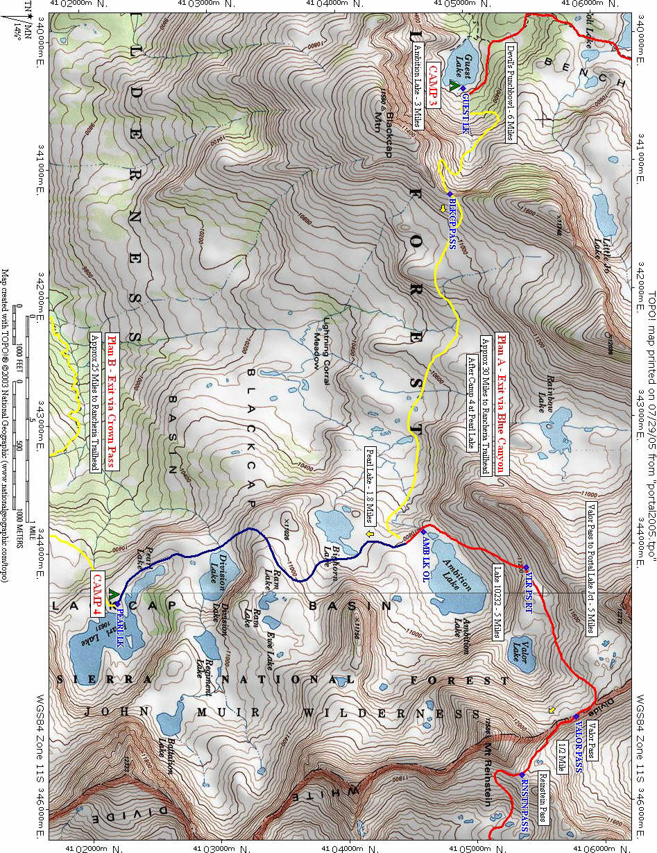
| Devil's Punchbowl to Guest Lake, via Two Passes | 6.0 Miles | CAMP 3 |
| Guest Lake to Pearl Lake, via Blackcap Pass | 3.8 Miles | CAMP 4 |
| Pearl Lake to Lake 10232, via Reinstein and Valor Passes | 6.8 Miles | CAMP 5 |
| Lake 10232 to Upper Blue Canyon, via Blue Canyon Pass | 5.2 Miles | CAMP 6 |
| Upper Blue Canyon to Hummingbird Lake, via Mantle Pass | 3.0 Miles | CAMP 7 |
| Hummingbird Lake to Gooney Bird, via Crown Creek Traverse | 5.3 Miles | CAMP 8 |
| Scepter Creek Camp to Rancheria Trailhead, via Chuck Pass | 9.5 Miles | END |
| |
|---|
| Plan B - Shuttle Trip from Maxson Trailhead to Rancheria Trailhead, via Crown Pass |
| Segment | Distance | Camp |
| Maxson Trailhead to Hobler Lake | 4.5 Miles | CAMP 1 |
| Hobler Lake to Devil's Punchbowl, via Fleming Creek and Post Corral | 9.6 Miles | CAMP 2 |
| Devil's Punchbowl to Guest Lake, via Two Passes | 6.0 Miles | CAMP 3 |
| Guest Lake to Pearl Lake, via Blackcap Pass | 3.8 Miles | CAMP 4 |
| Pearl Lake to Halfmoon Lake | 9.5 Miles | CAMP 5 |
| Halfmoon Lake to Rancheria Trailhead, via Crown Pass, Woodchuck XC | 14.0 Miles | END |
| (This route allows for other camp days, e.g. Portal Lake, Hummingbird Lake, etc.) |