These photos may be viewed as a slide show or an indexed list. There is also a trip map (BIG, 970K!).
These photos may be viewed as a slide show or an indexed list. There is also a trip map (BIG, 970K!).
When most people think of California mountains, the ones that usually come to mind are the Sierra Nevada, Mount Tamalpais, Mount San Jacinto, Mount Shasta, or maybe Lassen Peak. California has a lot more to offer than just those. Northeastern California is an extensive volcanic area, as shown in my Northern California Volcanoes 76/89 Photo Essay.
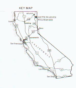
In July 1999, I had an opportunity to explore another remote area, the South Warner Wilderness, near Alturas, in the extreme northeastern corner of the state. This was a Sierra Club trip, sponsored by the Mother Lode Chapter, led by Alan Mendoza of Paradise, California. It turned out that Alan and I were the only participants on the trip, but he was gracious enough to complete it.
Our trip was a 45 mile loop, beginning and ending at the Patterson Meadow Guard Station, about 30 miles east of the town of Likely on US 395. Elevations on our route ranged from 6,800 feet to 9,200 feet. We hiked up the Summit Trail, to the North Emerson Trail, and then up the Owl Creek Trail, on the east side of the South Warner range. The Owl Creek Trail is not heavily used, and we encountered a lot of downed trees and other obstacles. The trail was often hard to follow, particularly on the far sides of the many meadows on the route. Along the way, we had numerous vistas of Surprise Valley, to the east.
The Owl Creek trail took us to the Squaw Peak Trail, which climbed to Summit Trail at the ridge crest, and Patterson Lake. This cold lake is nestled in a glacial basin, carved from Warren Peak. There, we saw a bald eagle dive into the lake and catch a fish. It was remarkable to watch the bird clutch the fish and struggle for altitude, finally clearing the ridge of Warren Peak.
From Patterson Lake, we proceeded south on the Summit Trail, often looking down on the Owl Creek Basin where we had been earlier. We were treated to magnificent views of Mount Shasta and Lassen Peak, as we passed through varied terrain and vegetation. We ended the trip on the East Creek Trail, which ended near Patterson Meadow.
It was a thrill to actually circumnavigate an entire mountain "range," seeing it from all angles. We were treated to great vistas at every turn. We did not encounter any bears or other large predators, but they were undoubtedly aware of our presence. We had been apprehensive about encountering cattle, since the western portion of the wilderness has been used for grazing. Apparently, this policy is under review, which would (in my opinion) be best for the overall environmental quality and land use in the area. However, we did see prodigious amounts of cow feces, from prior years. This added to the incentive to carefully purify our drinking water.
On this trip, I used my Samsung Automatic 35mm camera, with ASA 200 film. Enjoy the photos! You can view them as a slide show or an indexed list. (Note: If you spot any factual errors, please let me know.)
Best Regards,
Frank R. Farmer
Here is more information about South Warner Wilderness in Modoc National Forest.
ffarmer