You may view these photos as a slide show or an indexed list. There is also a trip map (BIG, 520K).
My two companions were Ron and Sara Karliner, who also joined me on my 1997 trip. The first leg was from Lodgepole Trailhead to Twin Lakes, where we camped the first night. This was a crowded campground, with lots of noisy people on short backpacking trips. It also had a pretty disgusting outdoor privy.
We began to leave the crowds behind on the second day, as we crossed Silliman Pass and traversed the Sugarloaf Valley. Actually, we saw people every day of the trip, but most everyone we saw was pretty nice. These included horse packers, Outward Bounders, Boy Scouts, solo hikers, and family groups. Our second campsite was on a moraine in Sugarloaf Valley.
On the third day, we passed through Roaring River Ranger Station, where we met some very hospitable Park Rangers. We then entered Deadman Canyon, making our third camp at Gravesite Meadow (not the official name!), near sheepherder Alfred Moniere's final resting place.
Next, we ascended Deadman Canyon to our fourth camp, at Upper Ranger Meadow, near Big Bird Peak. This placed us in the heart of mosquito country. A mosquito even got sucked into the lens of my camera, but luckily the pieces worked themselves out, without marring too many photos. We saw many trout in Copper Creek, which flows through Deadman Canyon. This creek also gave us some thrills, as we forded it about four or five times.
Our original plan was to ascend to just below Elizabeth Pass and traverse from Deadman Canyon over to Lonely Lake. From there, we intended to cross Pterodactyl Pass, into Tableland. We then planned to visit a high tarn above Big Bird Lake and descend to Pear Lake. We had planned to exit at Wolverton.
Our conditioning, attitude, and equipment were fine, but rain, hail, thunder, and the threat of lightning at the head of Deadman Canyon persuaded us to modify our route. We crossed Elizabeth Pass and descended to Lone Pine Creek. On the way down, we were caught in a drenching downpour. Our clothing kept us dry, but our feet got soaked, as boot waterproofing treatments became worthless. We took the Over-the-Hill Trail to Bearpaw Meadow, where we camped the fifth night.
The next day, we took the High Sierra Trail to Crescent Meadow, like the previous year. We caught a free park shuttle ride back to Lodgepole. Our car survived the week with no ill effects from weather, man, or beast.
Weather Notes: It turns out that the thunder and lightning storm we experienced on August 11 was caused by Tropical Depression Frank! Here is a GOES 10 Satellite Image and a Storm Track Plot.
Photo Notes: A number of my photos are in a large, panorama format, and are so labelled. My camera on this trip was a Samsung 38-125 automatic 35 mm model. It was a nice, light camera, but I'm afraid it's optics do not compare with my Canon AE-1P. In any case, I hope you enjoy the pictures!
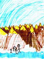
Acknowledgements: Inspiration for this trip came from Ron Karliner, Doyle Donehoo, Bill Finch, and Charles Hayden. The pen and ink drawing shown above was created by Melissa Lynn Farmer, to commemorate this trip.
Best Regards,
Frank R. Farmer
ffarmer
Copyright © 1998-2020 Frank R. Farmer - All Rights Reserved