Tiocampo's 2005 North Fork of the Kings Shuttle Trip Map

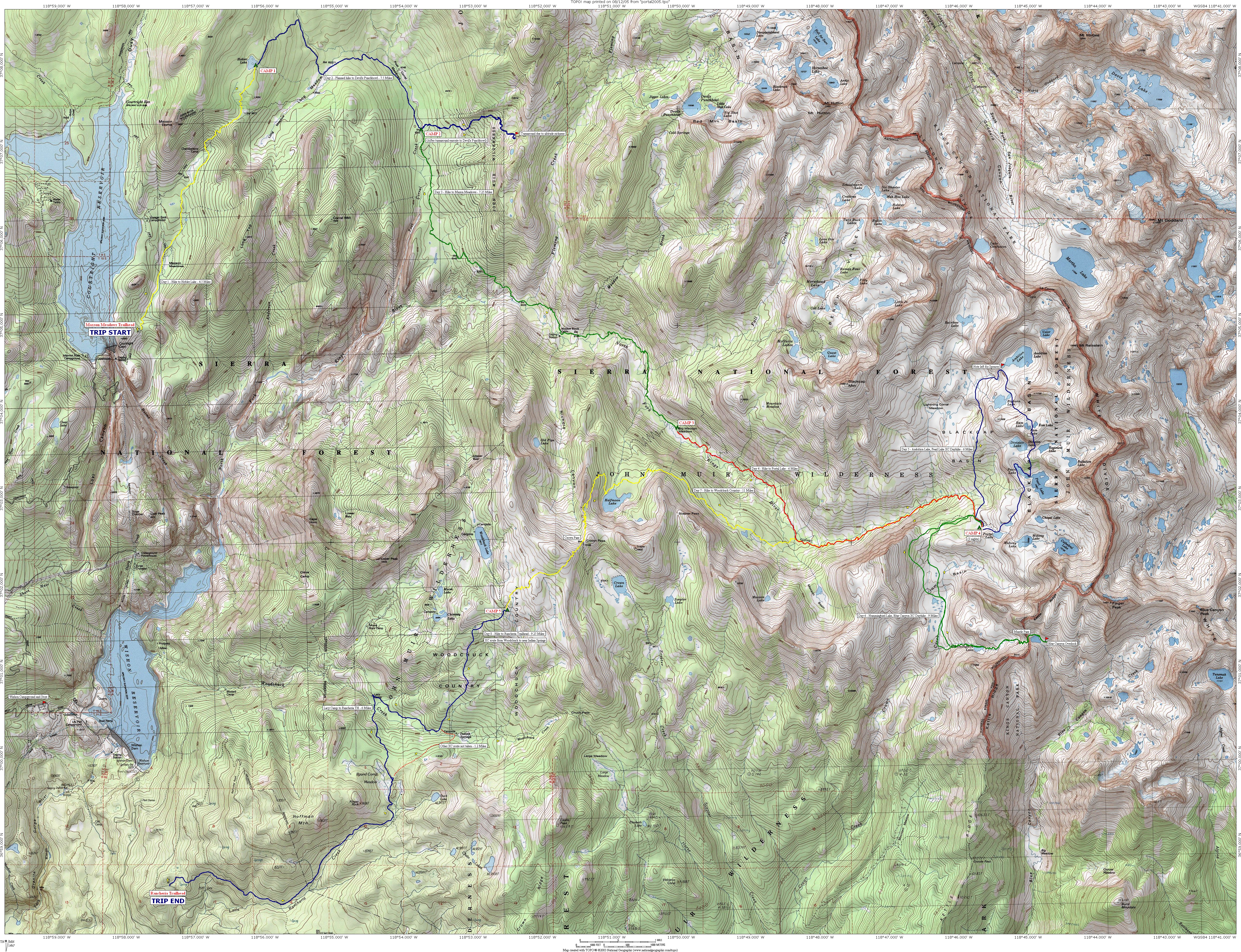
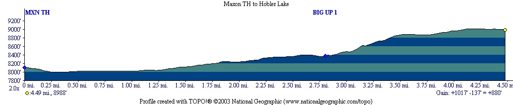
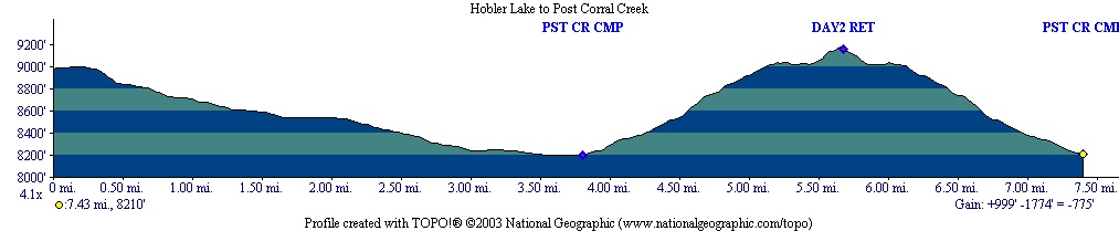
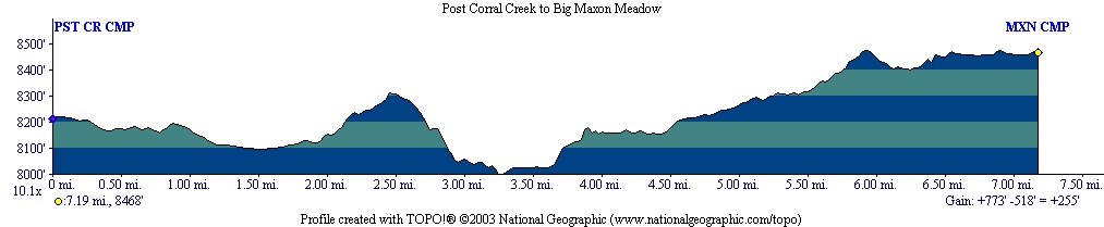
Terrific and adventurous August 2005 hike with Trailbunny. The original plan was for a loop trip from Maxson Trailhead to Devil's Punchbowl, Bench Valley, Guest Lake, Valor Pass, Reinstein Pass, Lake 10232, Blue Canyon Pass, Mantle Pass, Hummingbird Lake, Crown Creek, and Chuck Pass, then on to Rancheria Trailhead. This overall route was not possible, due to my own conditioning, the weather, and other factors.

Bill and Spencer also started this trip, but did not finish with us. Bill experienced altitude sickness on Day 2, so TB and I helped him return to the start point. Spencer continued on via the planned route to Devil's Punchbowl, intending to meet us at Ambition Lake. Bad weather forced him to end his trip early.

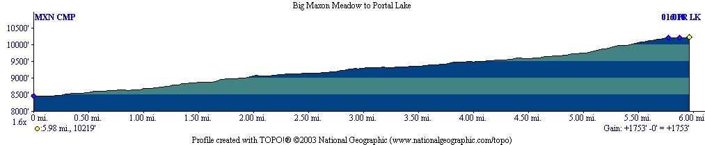
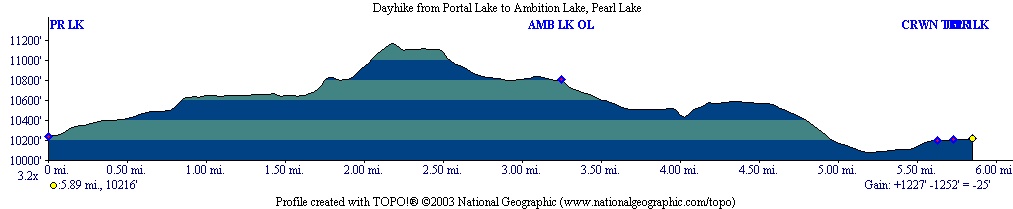
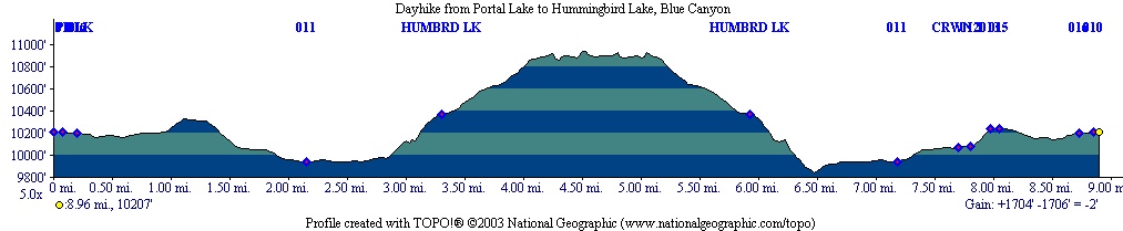
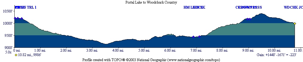
TB and I continued on, with the following route (45.5 Miles Backpacking, 15 Miles Dayhiking):

SegmentDistanceCamp
Maxson Trailhead to Hobler Lake - Profile 4.50 MilesCAMP 1
Hobler Lake to Post Corral, after turnaround
on Devil's Punchbowl Route - Profile
 7.50 MilesCAMP 2
Post Corral to Big Maxon Meadow - Profile 7.25 MilesCAMP 3
Big Maxson Meadow to Portal Lake - Profile 6.00 MilesCAMP 4
Portal Lake to Ambition Lake, Pearl Lake - Profile 6.00 MilesCAMP 4, Dayhike
Portal Lake to Hummingbird Lake, Blue Canyon - Profile 9.00 MilesCAMP 4, Dayhike
Portal Lake to Woodchuck Country - Profile11.00 MilesCAMP 5
Woodchuck Country to Rancheria Trailhead - Profile 9.25 MilesEND

 
We did not take the originally planned route, to Devil's Punchbowl and Guest Lake, over Valor and Reinstein Passes, and into the Goddard Creek Basin and Upper Blue Canyon. We also did not take the planned "Crown Creek Traverse," suggested by Llamabb. Our trip morphed into a basecamp trip, centering on the Portal Lake vicinity. I hope to visit these other areas in the future. I'll try to be in better condition, and hopefully the weather will be better on that occasion.

We used my Garmin Etrex GPS with stored waypoints quite a bit on this trip. Generally, the waypoints worked OK, but there were the following problems:

  • The GPS was not able to link up with satellites from under forest cover. Oddly enough, I can synch it up from inside my house, but not in a sierra forest with patchy tree cover.
  • Waypoints created in the TOPO! mapping program sometimes had longer names than the GPS could handle, resulting in truncation. The GPS was apparently unable to tell these waypoints apart, rendering them useless.

I am very grateful to Trailbunny for making this trip possible. It was a blast! Thanks for being so patient!

Pictures and Reports

Related Link

[Tiocampo's Hiking Trip Map Index Page] [Tiocampo's Mountaineering Page]  
ffarmer
Copyright © 2004-2020 Frank R. Farmer - All Rights Reserved